Indianapolis ⇔ Seattle/Tacoma

Paul’s Flights Airports Distance between Airports
2 INDSEA 1 861 mi · 2 994 km
Map of flight route between IND and SEA, created by Paul Bogard’s Flight Historian
Map generated by Great Circle Mapper
GPX · KML · GeoJSON
3 722 total miles · 5 989 km

Airlines Using INDSEA

# Airline Code Flights
1 NorthwestNorthwest NW 2
1 airline

Operators Using INDSEA

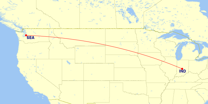
In many cases, an airline subcontracts another airline to operate flights for them. However, all of these flights were operated by their advertised airline.

Aircraft Using INDSEA

# Aircraft Family Flights
1 Airbus A320 Family 2
1 aircraft family

Classes Flown on INDSEA

# Quality Travel Class Flights
1 1 out of 5 stars Economy
Standard main cabin seat
2

Trips and Sections Using INDSEA

Trips with a INDSEA Flight

Map of flight routes with some routes emphasized, created by Paul Bogard’s Flight Historian
Map generated by Great Circle Mapper
GPX · KML · GeoJSON

Trip Sections with a INDSEA Flight

Map of flight routes with some routes emphasized, created by Paul Bogard’s Flight Historian
Map generated by Great Circle Mapper
GPX · KML · GeoJSON

Trip and Section Details

# Trip Section Departure
1 Washington Convention 15 Jul 2007
1 trip, 2 sections

INDSEA Flight List

# Flight Route Departure
1 NorthwestNorthwest 301 IND SEA 15 Jul 2007
2 NorthwestNorthwest 300 SEA IND 23 Jul 2007
2 flights (0.2% of all flights)